
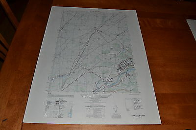
1950 Army (like USGS) topographic map Black River NY w/ Photo Sheet 5872 III SE - $30 - (Slingerlands, NY)
Back to Search Results
Posted 1 month ago
This is an Army Map Service map of Black River from the 1950 showing from the Black River north past Evans Mills to the Indian River. Shown is the Pine Camp Military Reservation which was used as a POW camp during the war. This map has a Photo Map on the reverse. This was developed as part of the war effort and was distributed to libraries after the war. This map is suitable for framing and guaranteed original. 22x29 1:25,000 Shipping is for US addresses and I will combine shipping. Shipping is done in a sturdy mailing tube. If you would like combined shipping, contact me prior to bidding.

ADVERTISEMENT
From ebay.com - 1 month ago