
8592 Results for For sale in Middleburgh Ny
This is an Army Map Service map (AMS V821) of Tully from the 1940's (printed 1946-50) showing Labrador Pond. Parts of the towns of Fabius, Truxton, Preble, Lafayette and Pompey are shown on the map. This was de…
1 month ago on ebay.com
This is an Army Map Service map (AMS V853) of Big Spring (printed 1947-50, using aerial photography from 1946), including High Plains, Corners, Bewleyville and Maples Corner. The reverse of this map is a full si…
1 month ago on ebay.com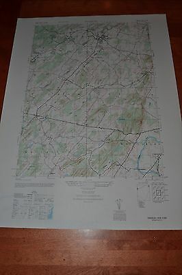
This is an Army Map Service map of Pinebush south to Milburn including the Shawangunk Mountains. These maps were developed as part of the war effort and were distributed to libraries after the war. This map is near …
1 month ago on ebay.com
This is an Army Map Service map (AMS V834) of Mabelton (printed 1947-49) showing Taylors Creek Mill, Goodall, Montpelier, Jones Corner, Moudges Corner and Goshen Cross Roads. The map is bisected by the South Ann…
1 month ago on ebay.com
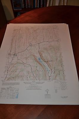
This is an Army Map Service map of Shandaken NY showing Big Indian, Panther Mountain and the Winnisook Lodge. These maps were developed as part of the war effort and were distributed to libraries after the war. This…
1 month ago on ebay.com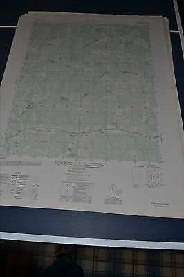
This is an Army Map Service map (AMS V834) of Hebron (printed 1948-50) showing Wilson, Ammon, and Liberty Church. The intersection of Amelia, Nottoway and Diniwiddie Counties is in the center of the map. This w…
1 month ago on ebay.com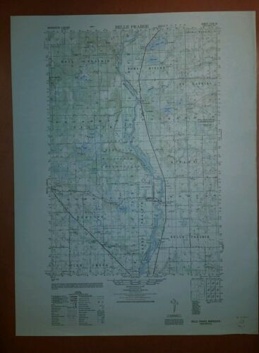
This is an Army Map Service map (AMS V772, printed 1949) of Belle Prairie showing south to Pike Creek. This map was developed by the US Army based on aerial photography from 1947 and were distributed to select libra…
1 month ago on ebay.com
This is an Army Map Service map of Freehold NY showing the Catskill Creek. These maps were developed as part of the war effort and were distributed to select libraries after the war. This map is near perfect, no yel…
1 month ago on ebay.com