
31295 Results for For sale in Altamont Ny
This is an Army Map Service map (AMS V814) of Paxton from the 1940's (printed 1950) showing Leicester north and west to Rutland; This was developed as part of the war effort and was distributed to libraries after th…
1 month ago on ebay.com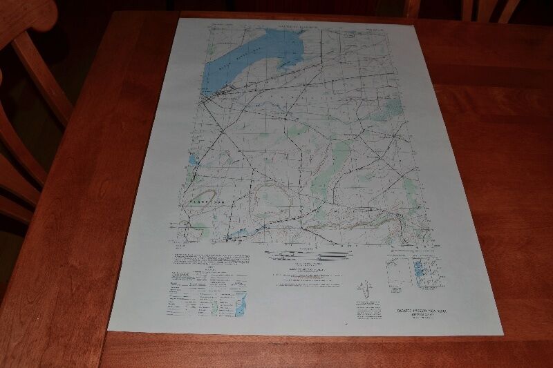
This is an Army Map Service map of Sackets Harbor on Black River Bay from 1946. These maps were developed as part of the war effort and were distributed to libraries after the war. This map is near perfect, no yello…
1 month ago on ebay.com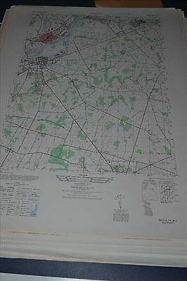
This is an Army Map Service map (AMS V822) of Bristol (printed 1948, based on 1942 aerial photography ) showing Roebling, Florence, Burlington and Mount Holly. nbsp; This was developed by the military as part of t…
1 month ago on ebay.com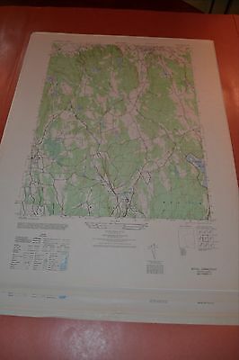
This is an Army Map Service map (AMS V814) of Bethel from the 1940's showing from Wilton and Georgetown north to Bethel. This was developed as part of the war effort and was distributed to select libraries after the…
1 month ago on ebay.com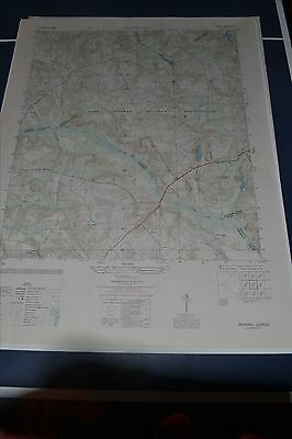
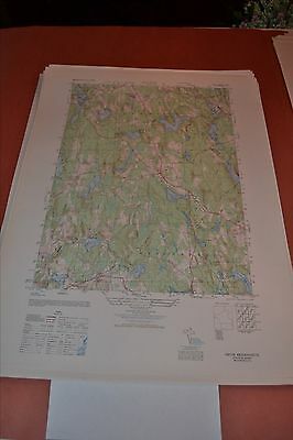
This is an Army Map Service map (AMS V845) of Avondale showing Camp Gordon Military Reservation. Counties shown include parts of Columbia, McDuffie, Richmond, Burke and Jefferson (printed 1950). nbsp; This wa…
1 month ago on ebay.com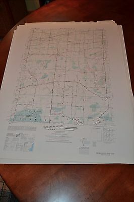
This is an Army Map Service map (AMS V821) of Knowlesville (printed 1946-50) on the Niagara Hudson System and New York Central Railroad and Erie Canal. To the south East Shelby and West Barre are shown along wit…
1 month ago on ebay.com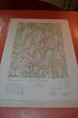
This is an Army Map Service map (AMS V814) of Norwich from the 1940's showing north to Sprague including the Thames River. This was developed as part of the war effort and was distributed to select libraries after t…
1 month ago on ebay.com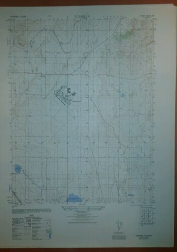
This is an Army Map Service map (AMS V877) of Elsmeere (Colorado Springs) Colorado (printed 1949 based on 1947 aerial photography) showing Peterson Field south to Big Johnson Reservoir. nbsp; This was developed by t…
1 month ago on ebay.com